Your message has been sent. Thank you!
 Your message has been sent. Thank you!
I'm ready to book
Hmm, I still need more information
My information
Detailed information
From $ USD
Ho Chi Minh Trail Motorcycle Tour – 12 Days

Duration:
12 Days/ 11 Nites

Destinations:
Hanoi - Nha Trang

Tour Level:
More offroad (>40%)

Highlight:
Destination:
Ha Noi
Mai Chau
Tan Ky
Phong Nha
Ke Bang National park
Khe Sanh
Vinh Moc tunnels
Hue
Da Nang
Hoi An
Kon Tum
Buon Me Thuat
Lak Lake
Nha Trang
Pickup from:
Hanoi, Airport or any hotel in Ha Noi city
Suitable Bikes:
Honda XR150L, Honda CRF300L,


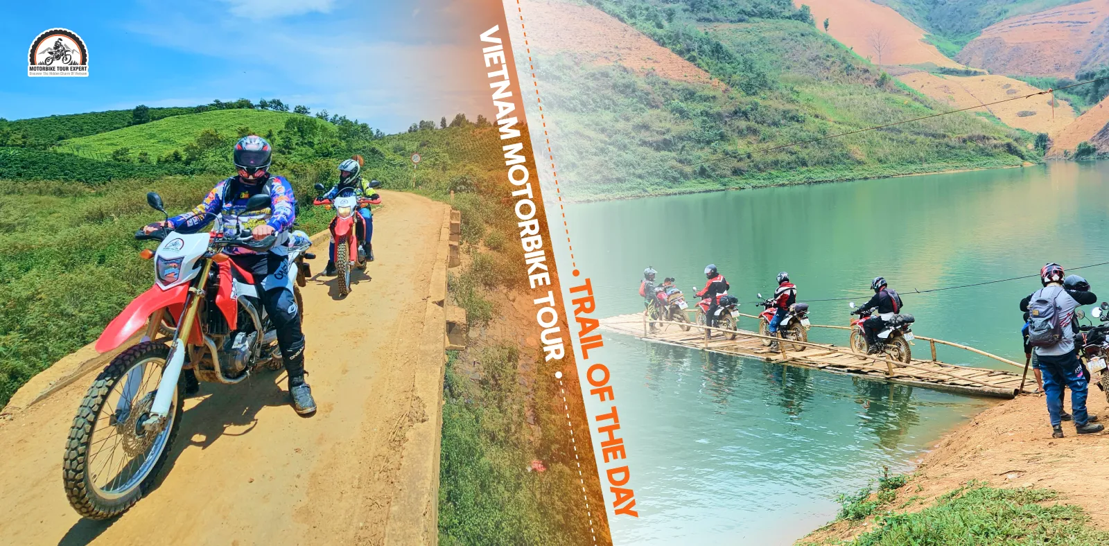



Muong Hoa Valley stretches for around 15 km just southeast of Sapa, with layered rice terraces running through villages inhabited by Black Hmong, Red Dao and Giay communities, including Lao Chai and Ta Van. The valley can be explored in half a day on foot or by motorbike, while a two-day stay offers more time to experience its scenery and local life at a slower pace. This guide introduces the best routes, villages worth visiting, entrance fees and the ideal months to see the terraces at their lush green or golden best.
Muong Hoa Valley lies roughly 6 – 10 km southeast of central Sapa, depending on the point you enter. Muong Hoa Stream runs through the terraced landscape toward Ban Ho, passing villages associated with Black Hmong, Red Dao, Giay and Tay communities. The upper valley around Y Linh Ho, Lao Chai and Ta Van is the most convenient area for a half-day visit from Sapa.
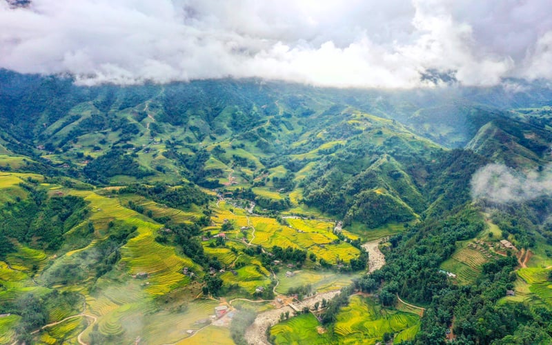
Muong Hoa Valley quick facts:
| Item | Details |
| Location | About 6 – 10 km southeast of central Sapa, depending on the entry point |
| Main villages | Y Linh Ho, Lao Chai, Ta Van, Hau Thao, Giang Ta Chai, Ban Ho |
| Ethnic communities | Black Hmong, Red Dao, Giay, Tay |
| Key sights | Rice terraces, Muong Hoa Stream, village trails, Sapa Ancient Rock Field |
| General sightseeing fee | No province-set general Muong Hoa Valley fee is listed in Lao Cai’s 2026 fee schedule; separate attractions and services may charge |
| Time needed | Half a day for the upper valley; 1 – 2 days for longer treks and village stays |
>> For a broader look at transport, weather and places to stay, explore our Sapa travel guide.
Muong Hoa Valley combines some of Sapa’s strongest landscape and cultural experiences within easy reach of the centre:
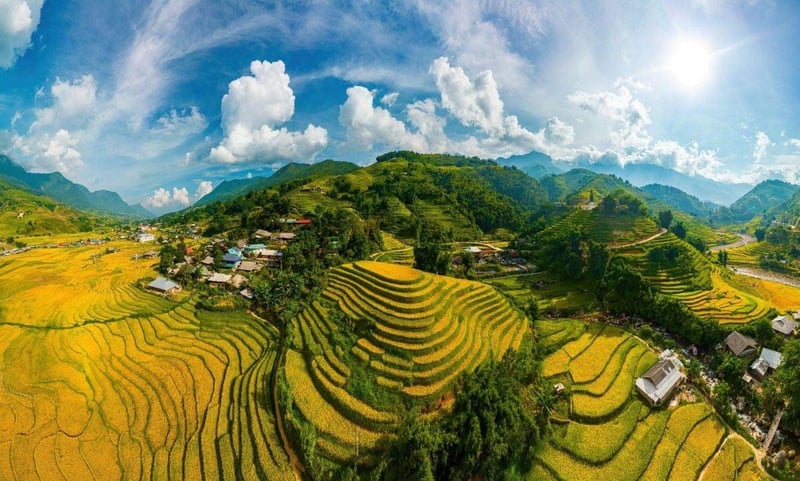
Travelling south from Sapa, a series of villages leads deeper into Muong Hoa Valley, each offering a different mix of mountain scenery, local culture and outdoor experiences.
Y Linh Ho is a hillside village closely associated with the Black Hmong community and surrounded by some of the steepest rice terraces in the upper Muong Hoa Valley. Elevated paths reveal sweeping views across the layered fields and down toward the Muong Hoa Stream, making this a rewarding stop for landscape photography. The village is also a popular starting point for the classic downhill trek that continues through Lao Chai and Ta Van.
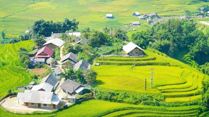
Lao Chai is one of the best-known Black Hmong villages in Muong Hoa Valley, surrounded by rice terraces that descend toward the stream below. Along the village paths, travellers can see traditional textile work and learn more about Hmong weaving and indigo-dyed fabrics. With gentle walking routes, open views across the terraces and opportunities to browse locally made handicrafts, Lao Chai is an easy and rewarding stop before continuing farther down the valley toward Ta Van.
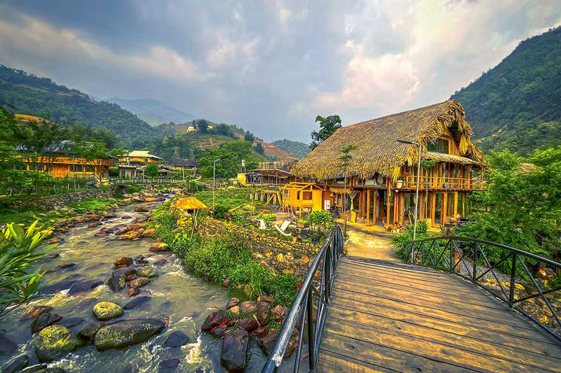
Set deeper in the valley, Ta Van is home mainly to Giay and Hmong communities, with Red Dao families also living in the surrounding area. Rice fields spread across the valley floor beside the Muong Hoa Stream, while traditional houses and the well-known suspension bridge add character to the landscape. Ta Van is particularly suited to an overnight stay, with plenty of homestays offering a slower introduction to village life. Read more in our Ta Van village guide.
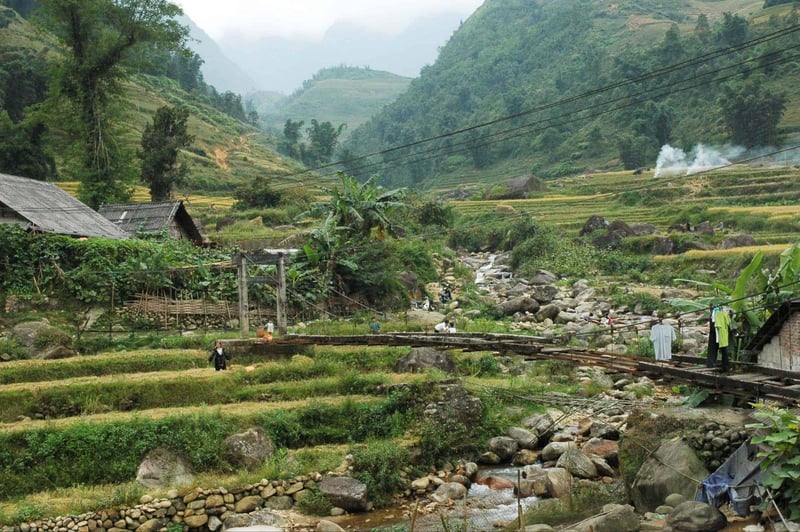
Hau Thao takes you away from the busier stretches around Lao Chai and Ta Van and into a landscape closely connected with Black Hmong communities. Part of the Sapa Ancient Rock Field extends through this area, with carved stones scattered from the roadside across terraced fields toward Hmong settlements higher on the slopes. The combination of open rice terraces and a quieter rural setting makes Hau Thao particularly appealing to walkers and photographers looking to explore beyond the valley’s most popular stops.
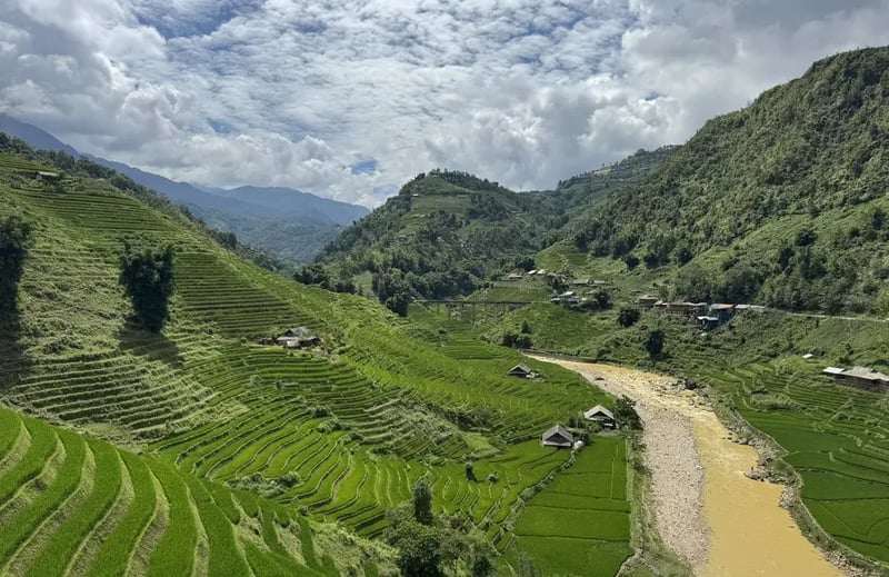
Farther down Muong Hoa Valley, Giang Ta Chai is associated with the Red Dao community and is known for its waterfall, bamboo groves and greener, more secluded surroundings. Continuing south brings you to Ban Ho, a Tay village near the meeting point of the Muong Hoa and La Vie streams. Red Dao communities around Sapa are also known for their traditional herbal baths. Together, these villages suit a two-day trek and travellers looking for a quieter, more remote side of Sapa.
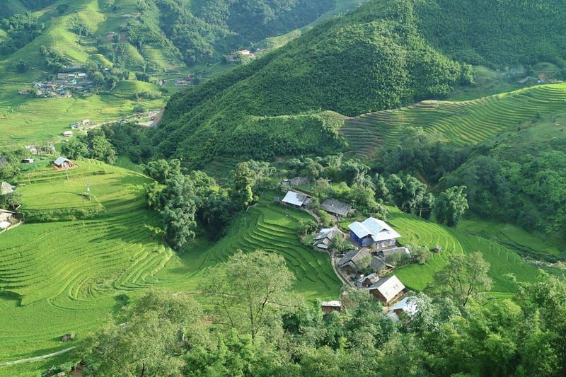
From trekking through rice terraces to riding mountain roads, Muong Hoa Valley offers several memorable ways to explore the landscape. You can also discover more experiences in our guide to the best things to do in Sapa.
Trekking is one of the most rewarding ways to explore Muong Hoa Valley up close. The classic downhill route passes through Y Linh Ho, Lao Chai and Ta Van, taking you along terraced fields, village paths and sections overlooking the Muong Hoa Stream. Routes range from short walks of around two hours to two-day treks covering roughly 5 – 20 km, with most trails considered easy to moderate.
| Tip: For longer or less obvious trails, consider a local guide. After rain, paths between the terraces can become muddy and slippery, so shoes with good grip are more useful than ordinary trainers. |
A motorbike gives experienced riders more flexibility to stop at viewpoints and move between villages. The paved road from Sapa toward Lao Chai and Ta Van follows the valley, with terraces opening across both slopes. In 2026, basic semi-automatic and automatic rentals commonly start around 100,000 – 160,000 VND per day, while manual or trail-style bikes usually cost more. Fuel is typically extra.
| Tip: Some sections of the road are narrow, steep and winding. Keep your speed low around sharp bends and avoid riding in thick fog or heavy rain when visibility is poor. |

The Sapa Ancient Rock Field adds an archaeological layer to the valley landscape. Official tourism sources describe nearly 200 carved stones spread across roughly 8 km², with motifs including human figures, geometric forms and map-like patterns. The site was recognised as a national historical-cultural monument in 1994, and the meaning and age of many carvings are still debated.
| Tip: Access to individual stones or protected areas can change as preservation work continues. Follow on-site signs and local guidance, and do not touch, climb on, write on or otherwise damage the carved surfaces. |
For a gentler sightseeing option, the Muong Hoa Mountain Train connects Sapa town with Muong Hoa Station, where travellers continue to the Fansipan cable car. The approximately 2 km journey takes only a few minutes and offers elevated views over the mountains and valley below. The 2026 reference fare is around 200,000 VND for a return ticket, although prices may vary by period.
| Tip: Combine the train with a Fansipan visit on a clear day, when visibility is better and the surrounding mountain scenery is at its most impressive. |
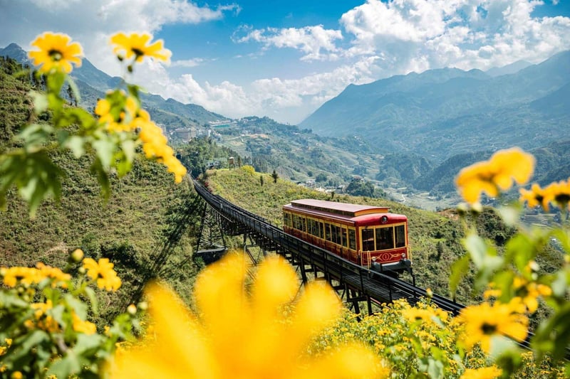
For rice-terrace scenery, the strongest windows are May – June and late August – early October. May – June brings the water-pouring and planting season, while late summer into early autumn shifts from green rice to golden fields before harvest. Exact timing varies slightly by village and year.
Muong Hoa Valley rice terraces by season:
| Months | Terraces look like | Notes |
| March – April | Mostly post-harvest terraces; spring scenery in the wider mountains | Mild days, but rice fields are not yet at their greenest |
| May – June | Water-filled terraces and fresh planting | Reflective fields and early green; showers become more frequent |
| July – August | Lush green terraces | Beautiful scenery, but heavier rain can make trails slippery |
| Late August – early October | Ripening green to golden rice | Most photogenic period; harvest dates vary by village and year |
| November – February | Mostly bare or post-harvest terraces | Colder, mistier and quieter than the rice-growing season |
Muong Hoa Valley is easiest to reach via Sapa, with several transport options depending on whether you prefer a quick transfer, an overnight journey or a more adventurous motorbike route.
>> Ride from Hanoi to Muong Hoa with a local guide on our Hanoi – Sapa motorbike tour.
A few simple preparations can make your time in Muong Hoa Valley more comfortable, especially if you plan to trek between villages or stay overnight.
8.1. How far is Muong Hoa Valley from Sapa?
Muong Hoa Valley begins roughly 6 – 10 km southeast of central Sapa, depending on the entry point. The upper valley is usually around 15 – 30 minutes away by road.
8.2. Can you visit Muong Hoa Valley without a guide?
Yes. You can explore the main road and short village walks independently, while a local guide is more helpful for longer trekking routes.
8.3. Is Muong Hoa Valley worth visiting in winter?
Yes, especially if you prefer quieter villages and fewer visitors. The terraces are usually bare, and cold or foggy weather can limit the views.
For the most rewarding scenery, visit Muong Hoa Valley in spring or around the autumn harvest, then explore the villages on foot or by motorbike at a relaxed pace. Spending at least half a day here gives you enough time to enjoy the rice terraces, local communities and quieter corners beyond central Sapa.
Want to see Muong Hoa from the saddle? Ride beyond Sapa’s usual sights with Motorbike Tour Expert and experience the valley as part of a memorable journey through Northwest Vietnam.

LET'S RIDE WITH US
 Duration:
4 Days/ 3 Nites
Destinations:
Hanoi - Vu Linh - Phu Yen - Moc Chau - Mai Chau - Hanoi.
Tour Level:
Chill Level Tours
 Duration:
11 Days/10 Nights
Destinations:
Hanoi - Thac Ba lake
Tour Level:
Chill Level Tours
 Duration:
11 Days/ 10 Nights
Destinations:
Hoi An - Saigon
Tour Level:
Chill Level Tours
 Duration:
8 Days/ 7 Nites
Destinations:
Hanoi - Ha Giang
Tour Level:
Chill Level Tours
 Duration:
9 Days/ 8 Nites
Destinations:
Hanoi - Thac Ba lake
Tour Level:
Chill Level Tours
 Duration:
7 Days / 6 Nites
Destinations:
Ho Chi Minh city - Da lat
Tour Level:
Chill Level Tours
 Duration:
11 Days/ 10 Nites
Destinations:
Hanoi - Hoi An
Tour Level:
Chill Level Tours
 Duration:
6 Days/5 Nights
Destinations:
Hanoi - Sapa
Tour Level:
Chill Level Tours
4-Day Northern Vietnam Motorbike Tour From Hanoi
 Duration:
4 Days/ 3 Nites
 Tour Level:
Chill Level Tours - Moderate Level Tours
Experience the authentic Vietnam
Ride off the beaten track
Visit beautiful Thac Ba Lake
Interact with lovely local people
Riding some scenic offroad tracks
Enjoy a variety of local foods
11-Day Grand Laos – Vietnam Motorbike Tour
Duration:
11 Days/10 Nights
Tour Level:
Challenging Level Tours - Moderate Level Tours
See the real Vietnam & Laos
Experience the authentic culture
Interact with lovely local people
Ride off the beaten track
Discover unreal landscapes
Enjoy Viet & Lao cuisine
11-Day Motorbike Tour Hoi An – Saigon
Duration:
11 Days/ 10 Nights
Tour Level:
Experience authentic Vietnam
Enjoy a variety of Vietnamese food
Ride off the beaten path
Interact with lovely local people
Visit the "Must-See" in central Vietnam
Explore the Ho Chi Minh road
8-Day Motorbike Tour Around Northern Vietnam
Duration:
8 Days/ 7 Nites
Tour Level:
Challenging Level Tours - Moderate Level Tours
Experience authentic Vietnam
Interact with lovely local people
Enjoy scenic off-road trails
Ride off the beaten path
Visit all the "Must-See" in North Vietnam
Explore Sapa & Ha Giang Loop
9-Day Offroad Motorcycle Exploring Northwest Vietnam
Duration:
9 Days/ 8 Nites
Tour Level:
Challenging Level Tours - Moderate Level Tours
Experience the authentic Vietnam
Great fun offroad riding
Amazing view of nature
Ride off the beaten track
Vietnamese culture discovery
Interact with lovely local people
7-Day Motorcycle Tour on Coastline and Highlands Vietnam
Duration:
7 Days / 6 Nites
Tour Level:
Chill Level Tours
Ride off the beaten track
Interact with lovely local people
Experience the authentic Vietnam
Visits a lot of historical sites
Enjoy fresh seafood/Vietnamese cuisine
Swimming at beautiful beaches
11-Day Vietnam Motorbike Tour Ho Chi Minh Trail
Duration:
11 Days/ 10 Nites
Tour Level:
Chill Level Tours - Moderate Level Tours
Experience the authentic Vietnam
Interact with lovely local people
Enjoy a variety of local foods
Ride some beautiful coastlines
Ride off the beaten track
Explore historical Ho Chi Minh trail
6-Day Offroad Motorcycle Tour Northwest Vietnam
Duration:
6 Days/5 Nights
Tour Level:
Challenging Level Tours - Moderate Level Tours
Ride interesting offroad tracks
Experience the authentic Vietnam
Interact with lovely local people
Ride off the beaten track
Visit beautiful Thac Ba lake & surroundings
Experience the traditions of the hill tribes